Tuesday, July 31, 2012

Civil War Road Trip, Day 1: Gettysburg


Day 1 started at the crack of dawn; we left the Worcester area at sunrise to make it to Gettysburg by 1pm, after hitting some traffic around Wilkes-Barre. We went straight to the beautiful new Visitor Center, which was packed – gorgeous Saturday afternoon, no surprise!

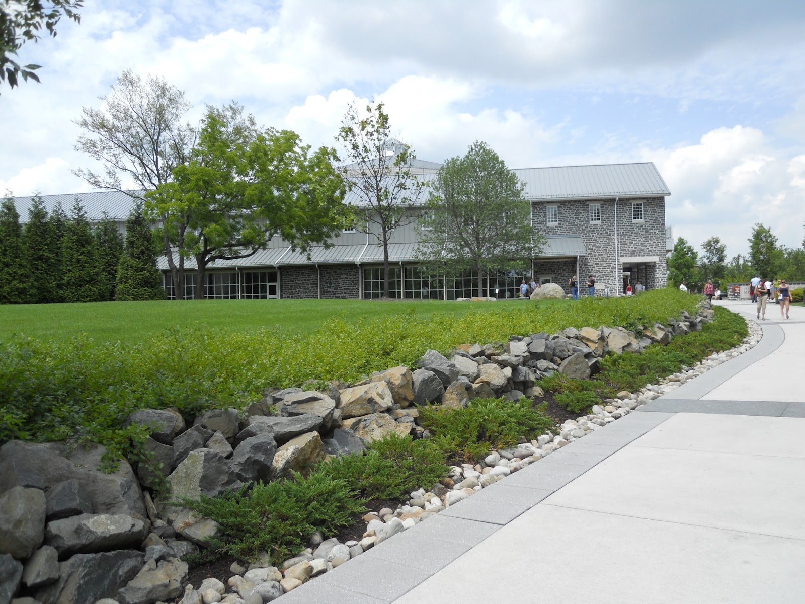
New visitor center at Gettysburg National Military Park
Honestly? It left me a bit cold. We saw the Gettysburg video, which had extraordinary production values, and the new installation f the Cyclorama, which gave me vertigo but was extraordinary in its detail. Its interpretation didn't add much to the battle itself, however; a lot of flash without much substance.

The re-installed Cyclorama
We bypassed the new exhibits – which I'd like to see someday – in favor of an auto tour of the battlefield, which took us several hours as we worked from both the audio CD we'd purchased and my notes and the 12th Pennsylvania regimental history by Martin Hardin to place Richard Gustin during the battle. We ended up having to loop back around again and climb up Big Round Top – the 12th Pennsylvania monument is at the very top of Big Round Top, where the regiment moved after holding the line on Little Round Top during the day of July 2.
Monument to the 12th Pennsylvania Reserves, at the summit of Big Round Top. I believe this is the highest monument in the entire park.
The battlefield itself is enormous and extraordinary and I think, on this brief visit, a bit difficult to parse meaning out of. I grasped the basics of the battle fairly quickly, but perhaps because of the sheer scale of everything, and the level of detail in all the interpretation, it was tricky to get a good takeaway feel.
The view from Devil's Den up Little Round Top
After the battlefield tour, we ventured into downtown Gettysburg to get Matt his kepi (which he will be wearing for the rest of the trip...), and then to the campground, where they were celebrating Christmas in July and fed us free burgers and hot dogs. Outstanding.

Wednesday, July 18, 2012

Why Do We Wear Pants?

Every so often I come across something I want to tag for my future research project. This blog post by Peter Turchin is one of them. Turchin talks briefly about the evolution of pants as a practical object of clothing. Essentially, a split garment came about in horse cultures, as it made it safer and more efficient to ride. I can attest to that personally!

One thing that struck me in particular about Turchin's research was this:
Before the introduction of horses by Europeans (actually, re-introduction – horses were native to North America, but were hunted to extinction when humans first arrived there), civilized Amerindians wore kilts.
But when the Plains Indians started riding horses they also adopted pants. Another correlation is that typically only men wear pants (or men are first to switch to wearing pants). 
Two things popped into my head when reading this:

1) The degree to which the Native American cultures were changed by horses is something that has certainly been explored from a scholarly POV, and something I will have to look at in more depth. It's not a strength of mine, currently. This is an interesting piece of material culture history that only adds to that argument.

2) There is some excellent work about the wives of cavalry officers in the late nineteenth century, and how their lives on the edges of civilization, among men, began to shift and their societal norms with them. Wearing pants - and in general shucking fashionable clothing for more practical and protective choices - is just one of those ways. The memoirs of Libby Custer bear this out, and will be one of my sources for the mustang project.

Friday, July 13, 2012

The Next Big Thing

I haven't yet blogged about my next major research project. I'm giving myself the summer off, my first extended stretch in recent memory without graduate or research work (beyond the day job, that is). Come this fall, however, I'll start digging into my shiny new ideas.

Basically, I want to look at the American mustang as an heritage symbol. I want to look at how the wild horse in the American west has been perceived, how it came to represent the culture of that space, how popular views of it played into preservation arguments that continue today. The research promises to fuse several things I find interesting: horses (I cop to the researcher's faux pas of working on something close to my heart, as I own and train a BLM mustang), the American West, the history of historic preservation, environmental history, the nineteenth century, and trying to put a finger down on a certain animating spirit.

My master's thesis investigated the tensions involved in creating the first regular, federal mounted regiment in American history, the United States Dragoons, and I found myself drawn to the more descriptive and narrative sections of the sources I was reading. How the dragoons thought about the land they were traversing - and the inhabitants of that land, both human and animal - often played back closely into their experiences in and perceptions of the military.

I'll start with travel narratives, both military and civilian. I've flagged over a dozen to start with. I have no pressing deadlines this time, other than my own curiosity, so I'll be moving more slowly than I have, and hope to take advantage of that to really build in a lot of contemplation time. There are all sorts of tricky historiographical questions to pull in as well, and I have some recommendations for good environmental and Western histories to use to begin to inform my thinking.

I'll be reporting back on my reading - both primary and secondary - and hopefully on my research trips and developing theories through this blog over the months. Watch this space starting in September.

Wednesday, July 11, 2012

Richard Gustin's Service and My Trip

In my previous post, I talked about Richard Gustin's life and my plans for a Civil War road trip that would overlap some of his footsteps while serving in the 12th Pennsylvania Reserves.

According to the PA Roots website, here's a list of activities of the 12th Pennsylvania. I've bolded major battles:

Duty at Tennallytown, Md., August 13 to October 10, 1861, and  at Camp Pierpont, near Langley, Va., to March, 1862.
Expedition to Grinnell's Farm December 6, 1861.
Action at Dranesville December 20, 1861.
Advance on Manassas, Va., March 10-15, 1862.
McDowell's advance on Falmouth April 9-19.
Duty at Fredericksburg till June.
Moved to White House June 9-12.
Seven days before Richmond June 25-July 1.
Battles of Mechanicsville June 26; Gaines' Mill June 27; Charles City Cross Roads,  Glendale June 30; Malvern Hill July 1.
At Harrison's Landing till August 16.
Movement to join Pope August 16-26.
Battles of Gainesville August 28; Groveton August 30; Bull Run August 30.
Maryland Campaign September 6-24.
Battles of South Mountain September 14; Antietam September 16-17.
Duty in Maryland till October 30.
Movement to Falmouth, Va., October 30-November 19.
Battle of Fredericksburg, Va., December 12-15.
"Mud March" January 20-24, 1863.
Ordered to Washington, D.C., February 6, and duty there and at Alexandria till June 25.
Ordered to rejoin Army of the Potomac in the field.
Battle of Gettysburg, Pa., July 1-3.
Pursuit of Lee July 5-24. Duty on the Rapidan till October.
Bristoe Campaign October 9-22.
Advance to line of the Rappahannock November 7-8.
Rappahannock Station November 7.
Mine Run Campaign November 26-December 2.
Guard Orange & Alexander Railroad till April, 1864.
Rapidan Campaign May 4-31.
Battles of the Wilderness May 5-7; Laurel Hill May 8; Spottsylvania May 8-12; Spottsylvania Court House May 12-21.
Assault on the Salient May 12.
Harris Farm May 19.
North Anna River May 23-26.
Jericho Mills, or Ford, May 25.
Line of the Pamunkey May 26-28.
Totopotomoy May 28-31.
Mustered out June 11, 1864.

There are some heavy-hitters in there: Second Bull Run, Antietam, Fredericksburg, Gettysburg, Wilderness.

So here's what our trip looks like, with links to the battlefields themselves, starred if they overlap with Richard's service (please note this is not exact both for privacy concerns and because I wanted to present a simple view; in many cases we're driving between places listed for large chunks of the day, not spending the entire day somewhere):

Day 1: Gettysburg*
Day 3: Hampton Roads, Manassas/Bull Run*
Day 4: Rest day, visit friends at Camp Lejeune
Day 5: Charleston, Fort Sumter
Day 7: Vicksburg
Day 8: Memphis
Day 10: Atlanta
Day 11: Knoxville, Great Smoky Mountains
Day 12: Appomattox, Monticello, Frederickburg*, Spotsylvania, Chancellorsville, Wilderness* (all in the same national park)
Day 13: Baltimore, Fort McHenry

It's obviously not a perfect overlap, but it combines perfectly a few things we're trying to do: visit Civil War sites, see more of the country, visit friends and family in far-flung places, and get in a few "must sees" - Monticello and Fort McHenry, in particular. (It also allows me a full expression of my inner National Park geek; I have a passport and am not ashamed to admit that I am utterly obsessed with collecting stamps.)

Friday, July 6, 2012

Following the Footsteps of the 12th Pennsylvania Reserves

I have been planning my graduation present to myself since practically before I began graduate school. In fact, it's been a dream of mine since high school, when my grandfather first showed me my many-times-great-grandfather's sabre and papers from his service in the Civil War. Over the years, I've done research on and off into his service, but now that I am finished with graduate school I'm finally taking up the planning and execution of a two week long road trip, visiting Civil War sites and walking in his footsteps.

Some background, first, with the understanding that I for the moment I am taking most of this at face value from contemporary sources; I haven't yet had the time to really dig into the context, background, or veracity of any of it. Richard Gustin was born in New Jersey on July 5, 1827. After a family reversal of fortunes, he moved to Pennsylvania, and on coming of age, bounced around a few professions before heading to Kansas to pursue business. During the Bloody Kansas crisis he fought on the side of the Free Soilers, apparently commanding a regiment. After Kansas, he returned to Pennsylvania, married a childhood friend and cousin, and farmed for a few years.

When the Civil War broke out, he did what many other men did: organized a group of men into a company, and attached that company to a newly formed regiment of volunteers. To be specific, he raised a group he called the "Troy Guards," which became Company C of the 12th Pennsylvania Reserves/41st Regiment of Pennsylvania Volunteers. The Troy Guards, and the 12th Pennsylvania, enlisted for a three year term on July 25, 1861, making Richard just turned 34 years old. He was elected Captain of his company by the men he had recruited.

The 12th Pennsylvania had quite a distinguished military record, and Richard, according to Colonel Martin Hardin, his commanding officer, never missed a single day of duty. He was injured once - shot in the hand during an ambush in December 1863 - and promoted several times. He often served above his rank, commanding the regiment a handful of times as a Captain before his promotion to Lieutenant Colonel. He received a brevet promotion to Colonel at the very end of the war.

As Colonel Hardin was a West Pointer with some prior military experience, in times of leadership vacuum he was brought up to command the brigade, and on several occasions, Richard assumed command of the regiment in battle as well as on march - Fredericksburg and Gettysburg being just two of those. Hardin claims in his memoirs that Richard commanded the entire brigade on occasion, but I haven't unearthed any evidence of that.

If I may be admiring and frank, Richard sounds like something of a badass. Hardin wrote of him later "He was ever the most conspicuous member of his command when the fighting was going on. He was one of the few men who seemed born without fear. He was repeatedly selected to lead the skirmishers - in short, he was one of the fighting field officers of the famous Third Brigade, Pennsylvania Reserves." (Hardin, 200-1)

Richard mustered out with the regiment on June 11, 1864, and returned to life as a farmer in Tioga County, Pennsylvania. His postwar life didn't turn out too terribly well, unfortunately; on April 12, 1877, he was driving a team of horses who spooked and ran out of control. The horses - and wagon - collided with an oncoming freight train, and Richard was crushed beneath its wheels, dying in a doctor's office shortly afterward.

Richard named his eldest son Grant Hardin Gustin, and both Grant and Hardin are family names to this day, which - along with our shared last name - is a comforting link to my past.

Next - I'll list the battles Richard served in, as well as the overall plans for my Civil War trip.

Wednesday, July 4, 2012

Found at Sea: Mapping Ships' Locations on the Eighteenth-Century Atlantic Brown Bag Lunch at the Massachusetts Historical Society

I was once again fortunate to be able to attend a brown bag lunch at the Massachusetts Historical Society on June 27. The speaker, John Dixon from Harvard University, shared with us an ongoing project called "Found at Sea: Mapping Ships' Locations on the Eighteenth-Century Atlantic."

In essentials, Dixon was taking ships' logs and translating their information into intricate maps via GIS software. It was a surprisingly original idea, and I was taken with some of the things he'd thought to map and compare.

One of his basic theories was that most of what we know about routes back and forth across the Atlantic in the late eighteenth-century - he was looking at approximately 1775-1800 - comes from idealized sources. Sailors and merchants would publish routes that they believed offered the best advantages in speed and safety, and there were generally agreed-upon trends such as going east in a northerly arc and going west in a southerly arc to take advantage of the clockwise trade winds.

However, until Dixon began mapping, there was really no good way to quantify large quantities of information gathered by actual sailors back and forth across the Atlantic. Did they actually follow those idealized routes? If they deviated, what caused their changes?

Using GIS software allowed Dixon to visually represent those actual routes, and by including data points he could start to see other patterns - for example, in wind, in distance sailed, in weather, and through encounters with other ships - and characterization of those encounters as hostile, friendly, or neutral. Mapping many ships could start to expose patterns in international shipping lanes - one of the best questions from an attendee was whether Dixon belied his work would provide a new way to talk about conceptions of national boundaries at sea. Was there a clear sense of national identity among merchants and sailors, or were there occasions in which a maritime identity trumped that nationalistic sense? (He thought it would, but wasn't far enough along to offer any theses of his own.)

One thing I learned and was glad to think about was how fluid the ideas of communication and location were while at sea. For one thing, while latitude was fairly easy to make, no one had yet come up with a simple and easy way to mark longitude. Ships could be much further east or west than they thought, and would often hail other ships to compare longitude in order to get a fix.

For another, sometimes it was difficult to discern the nature of an encounter at sea. Sometimes French warships chased French merchant ships and only realized their mistake when they caught up; sometimes ships chased one another without ever knowing the identity of another ship; sometimes there were genuinely hostile or friendly encounters that lasted for days. Thus, even what ultimately was a friendly encounter could have all the characteristics of a hostile encounter.

I love projects that do what Dixon did: harness the power of technology to expose new and interesting ideas about history. Maritime history can particularly benefit from GIS systems. I was intrigued to think about how I could apply some of these same ideas to my own work - the catch, unfortunately, is that cavalry officers rarely, if ever, recorded their latitude and longitude with the same precision as sea captains.